


Pasadena City Hall aerial view (Photo – ColoradoBoulevard.net).
The City of Pasadena has deployed a professional-grade air quality sensor at the Pasadena Public Health Department (PPHD), officials announced this week.
By News Desk
The sensor installation, led by the California Institute of Technology (Caltech), aims to provide real-time data on airborne particulate matter, especially PM10, which includes dust and ash particles that can pose health risks.
The announcement was made by Manuel Carmona, Director of Public Health, who emphasized the importance of this initiative in supporting post-wildfire recovery efforts.
The new sensor is part of a broader network of over 25 QuantAQ Modulair-PM sensors deployed by Caltech across Pasadena and Altadena. This network, known as PHOENIX (Post-fire airborne Hazard Observation Environmental Network for Integrated Xposure-monitoring), delivers public access to localized air quality data through an interactive online map.
The effort is a direct response to the destruction of previous air monitoring equipment during the wildfire, which had left significant gaps in the region’s environmental data. In February 2025, Caltech began deploying new sensors to fill those gaps and has since been providing critical air quality data to local residents.
The PHOENIX network is being spearheaded by a team of researchers including Haroula Baliaka, a Ph.D. candidate in Environmental Science and Engineering; Paul Wennberg, R. Stanton Avery Professor of Atmospheric Chemistry and Environmental Science and Engineering; Coleen Roehl, Associate Research Scientist; and Nikos Kanakaris, a machine learning researcher.
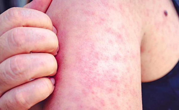
PM10 particles, which are 10 micrometers or smaller in diameter, are known to aggravate respiratory conditions and cause symptoms such as coughing, congestion, and eye irritation. These particles originate not only from wildfires but also from vehicle emissions, construction sites, and other sources.
Health officials are urging the public to monitor air quality levels, particularly those living or working near the fire-affected areas, and to limit outdoor activities during periods of poor air quality. The PHOENIX map offers a user-friendly interface for checking localized conditions in real time.
The project is expected to continue through the fall of 2026.


Three months later… better late than never.