

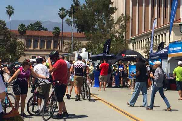
 Since CicLAvia announced its Pasadena route, cyclists and enthusiasts alike who were excited about the event, started raising questions about certain aspects of it.
By Vahe Simonyan
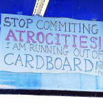
One of the immediate concerns raised on social media, was the fact that the Pasadena route was “shortened” compared to other CicLAvia events in the region.
Here’s an example:

CicLavia responded with the following explanation:

The attention shifted toward the role the city of Pasadena had in affecting the route.

Theories and accusations started fueling social media chats. Colorado Boulevard contacted City Hall looking for answers. We conveyed our concerns to Mr. Mark Yamarone, from the Department of Transportation, in the form of three questions.
Why was the CicLAvia route “shortened” from the normal 5 miles to the current 3.5 miles?
The purpose of the CicLAvia-Pasadena route is first and foremost to connect cultural, architectural and historical destinations within the city, rather than to focus on a specific mileage. The route we selected also provides both proximity and access to commercial corridors as well as access to three Metro Gold Line stations. The goal of CicLAvia and the City is for the event to create vibrant public spaces, active transportation and good health through car-free streets.
Was there an option to stretch the route further west to incorporate the Colorado St. Bridge?
We did initially want to have the route extend west over the historic Colorado Bridge which would have added about a mile to the total length of the route. However another bridge over the Arroyo Seco, the La Loma Rd. Bridge, is scheduled to be closed for a seismic retrofit and the Colorado Bridge will be a critical link for residents and safety services in the West Arroyo to access Central Pasadena and the Huntington Hospital. To ensure public safety in the West Arroyo area, a moratorium was placed on any events that would close the Colorado Bridge to traffic from Spring 2015 to Fall 2016.
Why was Pasadena City Hall not chosen as a scenery stop, if the bridge was not a viable option?
When we looked at a route that would pass directly by City Hall we discovered that such a short addition to the route would require an additional car crossing point and another dismount zone.
The Pasadena event is expected to be the most walkable CicLAvia to date.


For a city that shuts down almost the entire length of Colorado Blvd once a year for half a day, this seems like it would be the easiest thing EVER!
This route is a snub to East Pas and North Lake! It also is in indication about how City Hall feels about pedestrians, bikes, and public transport. Glendale is already proposing their own CicLAvia.
Please extend Lake from California to Washington, Mountain, or Orange Grove!
Please extend Colorado from Pasadena Ave to Rosemead or Madre!
Please extend Fair Oaks from Colorado to California!
Hold events in front of City Hall as well as Central Park!
We have a “bikeable” CITY with some great Metro stations. It’s not just Old Pas and South Lake!