


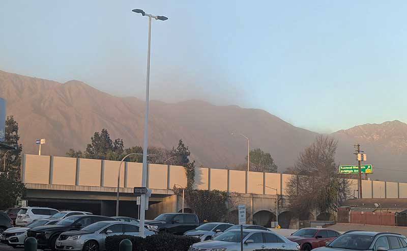
A view from Pasadena towards the mountains during a wind storm, Jan. 23, 2025 (File Photo – ColoradoBlvd.net)
A Flood Watch is in effect for the Eaton Fire burn areas as a significant storm system is expected to bring substantial rainfall from today through Monday.
By News Desk
The storm continues to trend wetter, with rain anticipated to begin as early as Saturday afternoon or as late as this evening. In the town of Altadena, rainfall totals could range from 1.0 to 1.5 inches, while the burn areas in the mountains above could see between 1.5 to 2 inches of rain.
Rainfall is expected to intensify throughout the weekend, with a 90% chance of at least 0.25 inches by Sunday afternoon, increasing in likelihood thereafter. There is a 70% chance of 0.50 inches, and a 45% chance of reaching 0.75 inches by Sunday afternoon, with totals likely climbing as the storm progresses. There is a 15% chance the rainfall will reach 1 inch by Sunday afternoon, with higher amounts possible later.
Widespread rain rates are expected to stay under 0.25 inch per hour, according to the National Weather Service in Los Angeles/Oxnard, but there is a 10-20% chance that the rainfall will intensify, producing rates greater than 0.50 inch per hour. These stronger rates, which could trigger mudslides and debris flows, are most likely to occur on Sunday night and Monday morning.
Snow levels are expected to range between 3500 and 4000 feet, but with heavier downpours, snow levels could drop to as low as 2500-3000 feet.
The storm also brings a 15-25% chance of thunderstorms, particularly Sunday afternoon and night, though the likelihood of small hail or a tornado is extremely low at under 5%.
The National Weather Service in Los Angeles/Oxnard, in coordination with the Department of Conservation, is monitoring the storm’s progression and urges residents in affected areas to stay alert for rapidly changing conditions.


Leave a Reply